General Pedernera Department (Departamento de General Pedernera)
General Pedernera is a department of San Luis Province, Argentina.
With an area of 15057 sqkm it borders to the north with the department of Coronel Pringles and Chacabuco, to the east with Córdoba Province, to the south with Gobernador Dupuy and to the west with Juan Martín de Pueyrredón.
Its name pays homage to Lieutenant-general Juan Esteban Pedernera who fought with the Regiment of Mounted Grenadiers during the Argentine War of Independence and became the interim president of the Argentine Confederation.
On October 14, 2009, the government of San Luis passed the decree of need and urgency No. 2884 MGJyC 09, which created the municipality of the Ranquel people-nation in 66.000 hectares of the General Pedernera Department, so as to provide a settlement for members of the Ranquel native people. In addition, a delegate was designed to manage the municipality, organized according to the traditions and customs of the Ranquel people.
According to the 2010 national census, there are 125.470 inhabitants in the department.
* Juan Jorba
* Juan Llerena
* Justo Daract
* La Punilla
* Lavaisse
Map - General Pedernera Department (Departamento de General Pedernera)
Map


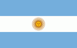
Country - Argentina
 |
 |
| Flag of Argentina | |
The earliest recorded human presence in modern-day Argentina dates back to the Paleolithic period. The Inca Empire expanded to the northwest of the country in Pre-Columbian times. The country has its roots in Spanish colonization of the region during the 16th century. Argentina rose as the successor state of the Viceroyalty of the Río de la Plata, a Spanish overseas viceroyalty founded in 1776. The declaration and fight for independence (1810–1818) was followed by an extended civil war that lasted until 1861, culminating in the country's reorganization as a federation. The country thereafter enjoyed relative peace and stability, with several waves of European immigration, mainly Italians and Spaniards, radically reshaping its cultural and demographic outlook; over 60% of the population has full or partial Italian ancestry, and Argentine culture has significant connections to Italian culture.
Currency / Language
| ISO | Currency | Symbol | Significant figures |
|---|---|---|---|
| ARS | Argentine peso | $ | 2 |
| ISO | Language |
|---|---|
| EN | English language |
| FR | French language |
| DE | German language |
| GN | Guarani language |
| IT | Italian language |
| ES | Spanish language |